|
|||||||||
General DescriptionThis part of the Colorado river is free-flowing and virtually hazard-free, with the exception of the occasional boulder or gravel bar. Good water navigation skills will be an advantage. With low water, some shoal areas exist. However, they are typically short and should present no problem. The water quality is generally clean and clear except following heavy rains, which stir up the red sand resulting in muddy water. |
| Name | Description |
|---|---|
| STARTING LINE | The Texas Winter 100k will start on |
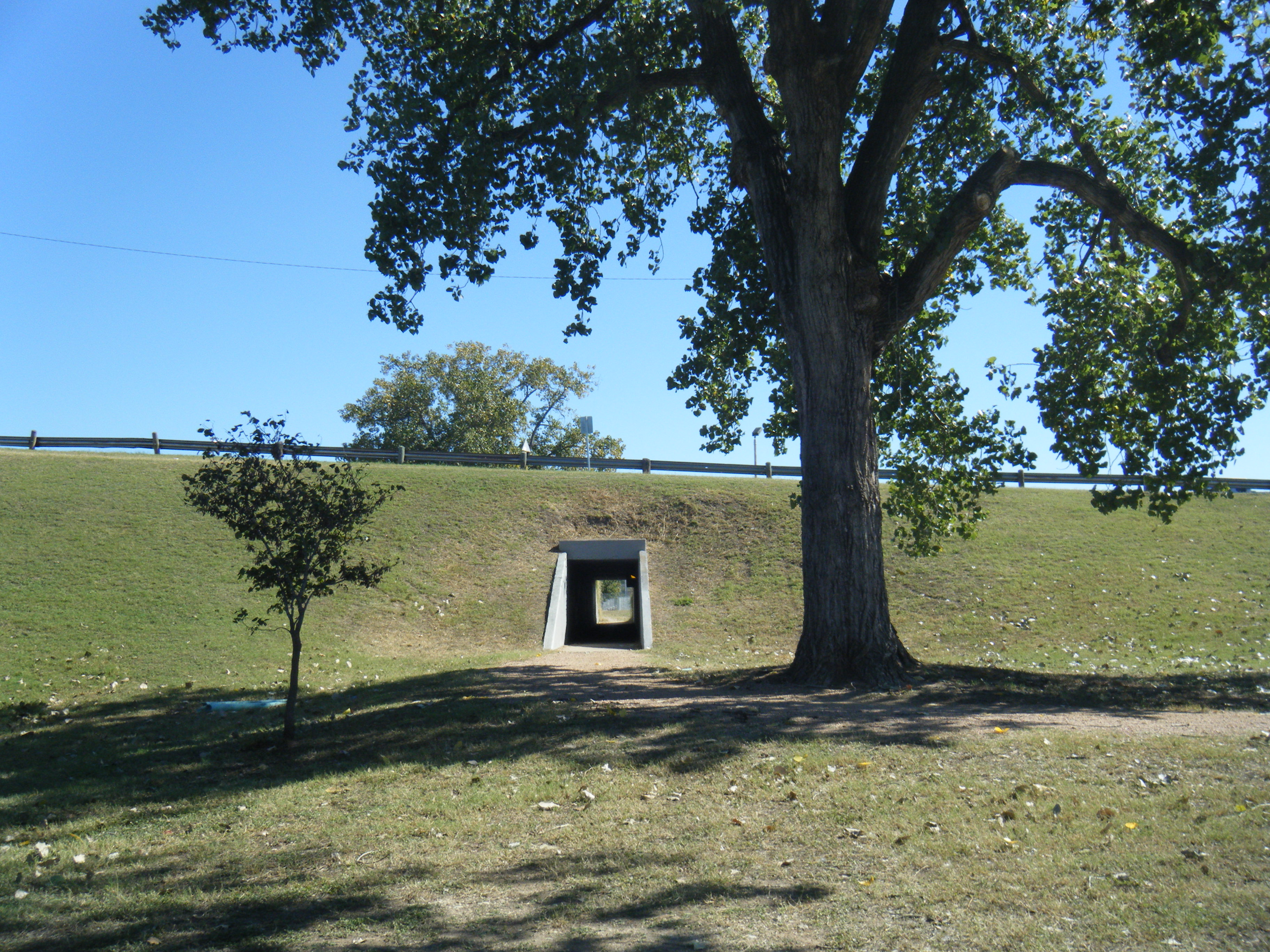
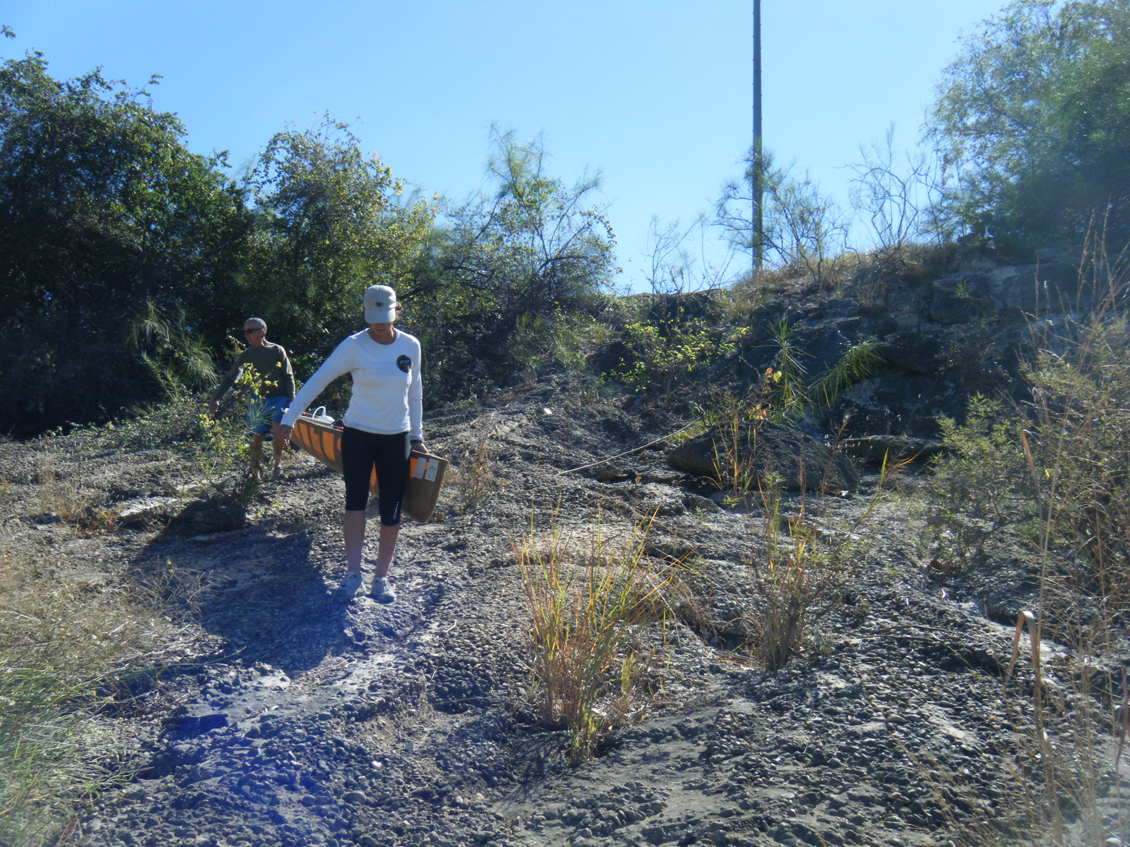
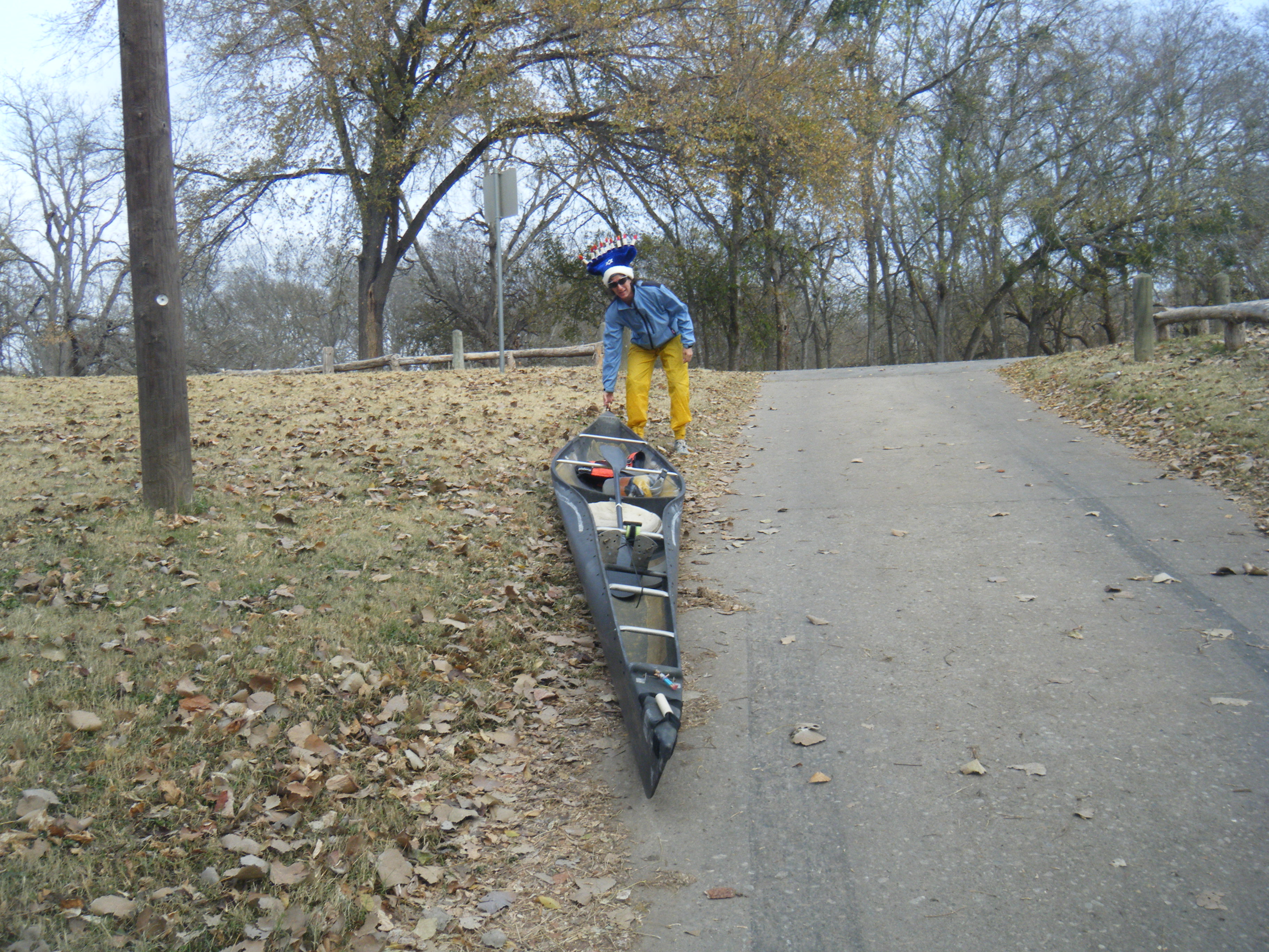
| Long Horn Dam Portage | Racers will head downstream towards Interstate 35 and No Name Island. Once around No Name Island racers will be able to see the take-out for the portage about 200 yards to the right of Longhorn Dam. The take-out will be well lit and manned by race officials. There is a large pipe fence that follows the shoreline from the dam down south into the lagoon. The large pipe fence looks like it's used to prevent erosion or something. The portage take-out will be at the end of the large pipe fence. Portage Route: Once up and out of Lady Bird Lake, racers will drag, carry and/or cuss their racing craft to the left along the gravel running trail towards the dam. Once Pleasant Valley road starts to head uphill to the bridge over the dam, a pedestrian tunnel will be in view for the racers to convey their bodies and boats. Race officials will have the portage route lit with lights and with luck people telling you were to go. The portage to the safest put-in is about 0.31 miles. Take Note: It is perfectly within the rules to have assistance hauling the boat over the portage. This means you can have twenty of your best friends waiting at the portage take out to pick you and your boat up and haul you all the way to the put in point. The tunnel must be used. Any team going across the road will be disqualified - regardless of how little traffic is present. Put-in Point: After getting through the tunnel alive, racers will follow the gravel trail to the left. Now, there won't be any rules dictating where racers have to re-enter the river after the portage, however there will be a series of lights and surveyors ribbon and cones to follow to the safest possible put-in point. Either way you choose to go, there will be some unfinished rough concrete to walk down carrying your boat, so be careful. Headlights will be a life saver for the Adventure Class racers at this point, so that's a strong recommendation along with the mandatory head light or bow light. Portage Into Colorado River. 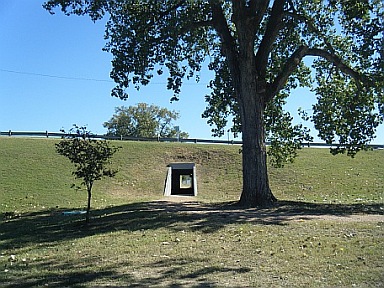 Pedestrian tunnel  Rough concrete 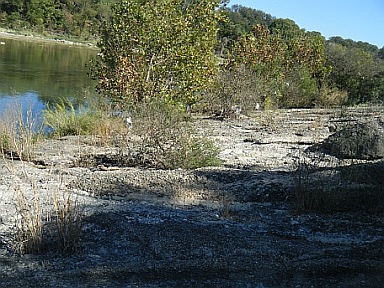 Put-in place |
| SH 183 | About 1.41 miles down from the Longhorn Dam put-in (not the dam), you'll come across the SH 183 bridges. This is near Callahan's General store and the Landing Strip, for you locals. |
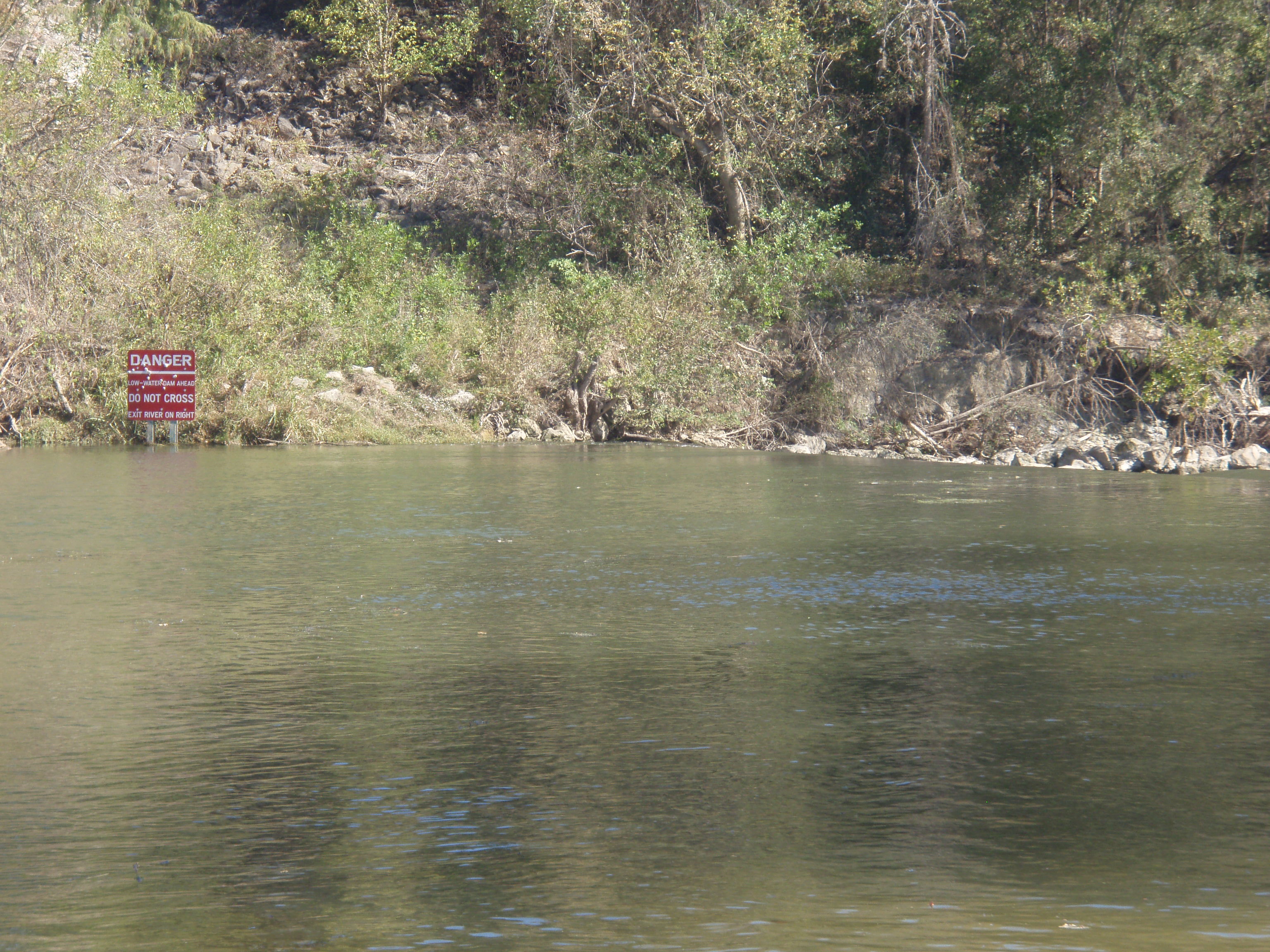
| Sheila's Devil Dam | About 8.0 miles from race start (6.3 miles from the Longhorn Dam put-in), you'll run into Sheila's Devil Dam. It was named thus by her main squeeze, who noticed that the dam was about 6.66 miles from the start of our scouting trip that went on far longer than they planned. A sign on the left tells you to WATCH THE HELL OUT! and to portage on the right. This is a spillover dam that'll ruin the day of the unexpecting. Surf ski's and ABS boats may be able to survive a run down the middle tongue, but it's strongly recommended everyone take the easy portage path on the right that's been softened by sand and poison ivy. It's an easy take out and put in.
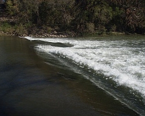 The Dam Dam 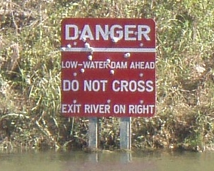 Warning Sign 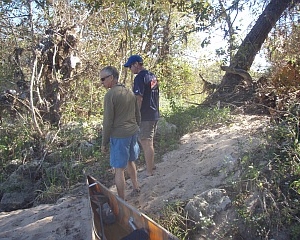 Portage Right Could you come in and shave some of the ivy out |
| FM 973 | This is an old bridge not far from Bergstrom Airport. It's about 12.9 miles down from race start. |
| Toll Road 130 | It's big and brand new and has cool Texas stars on it. Look for it exactly one mile after the 973 bridge. From here on out it's just pretty scenery on the way to Little Webberville Park. |
| CHECKPOINT 1 Little Webberville Park |
This concrete boat ramp will pop up on you immediately after a house on the bluff on the left. The park is about 24.6 miles from race start, which makes it around 10.7 miles from the last bridge at the toll road. Pic of Little Webberville Ramp. My mom is in charge of this checkpoint, so say howdy to Ann. |
| Right Cut | There's a large island about 1.4 miles down from Little Webberville. It doesn't look like an island, only a strong cut that takes a 90 degree turn to the right that looks like it goes nowhere. The left channel is very shallow and peters out to some bottom scraping before joining the main channel, which it turns out, is that 90 degree cut that takes off to the right. |
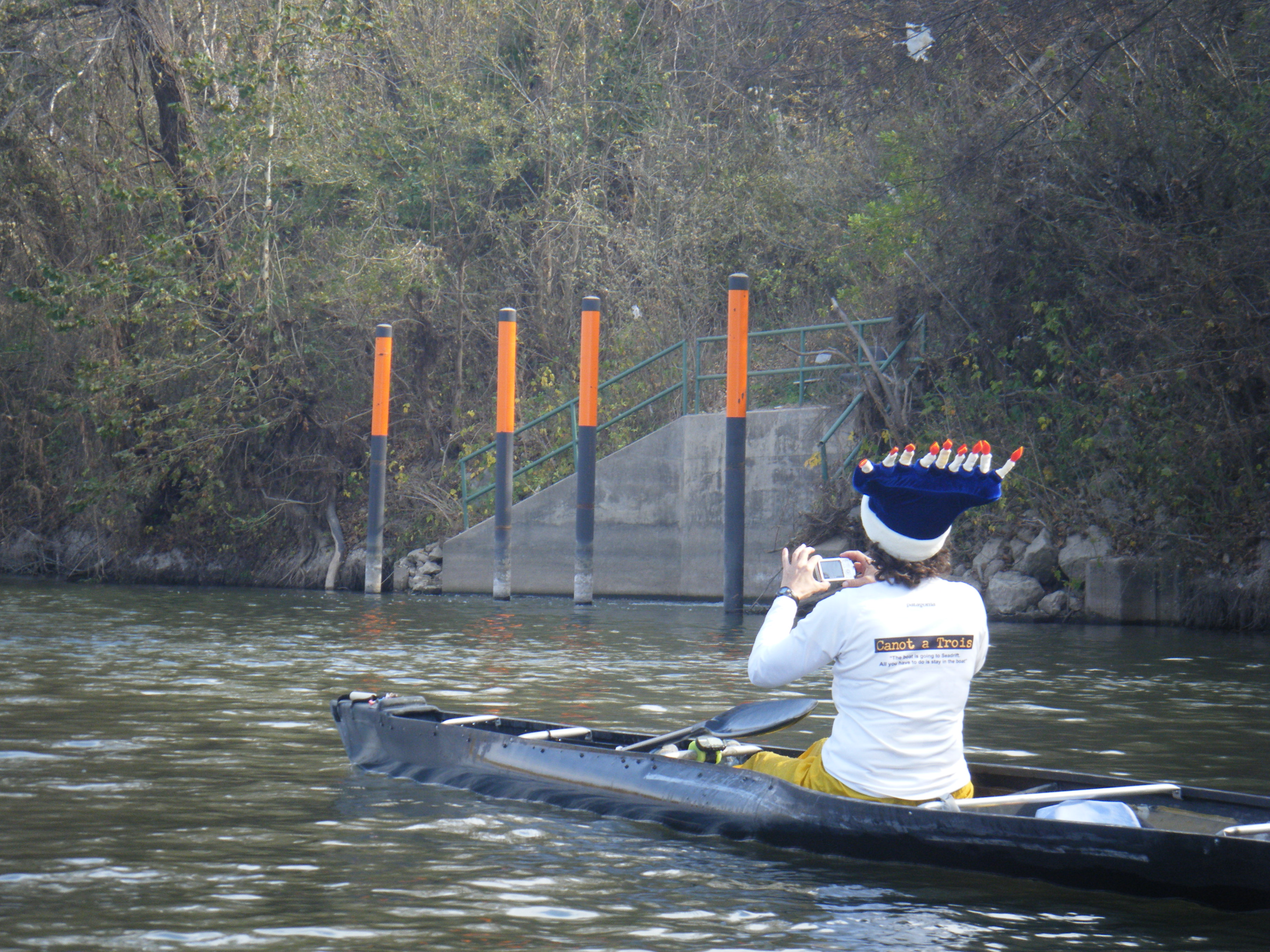
| Pump Station | A pump station is marked by some tall orange poles and some impressive stairs on river right. This is about 3.8 miles downriver from Little Webberville. Be wary of Hanukkah paddlers wearing Menorahs on this section. |
| Oficial Meeting Place Big Webberville Park |
This is a large county park with real restrooms, picnic tables and beautiful pecan trees. I must say, this is one of the nicest kept parks I've ever seen. It's too close to Little Webberville to be an official checkpoint, but it's a really pleasant place to meet your bank crew. Volunteers will be on hand. The boat ramp, on river left is 5.0 miles down from Little Webberville Park and 28.1 miles downriver from Longhorn Dam. Big Webberville is about the halfway point for the Texas Winter 100k. Picture of Big Webberville Ramp. |
| Hyatt Lost Pines Resort | Located on river right, this beautifully manicured luxury resort is not an official checkpoint and word from the resort staff is that racer support personnel are not welcome to meet their racer here, so don't even try. Racers who run into trouble and need to exit the river will find a gravel bar at the start of the land where a small, mostly dry, creek spills into the Colorado. A few yards further there is a gorgeous dock with steps leading up to the resort, where it's a common practice for people to arrive by cars via SH 71. Therefore, do as you wish, but I'm not encouraging anyone to meet their racer or for racers to emergency exit the race at the Hyatt Lost Pines Resort which is located approx 9 miles west of Bastrop with the main entrance immediately right after McKinney Roughs Nature Park. I don't recommend you turn right onto main drive and follow three mile drive to lobby entrance. |
| McKinney Roughs LCRA Park | The park is a really cool place and I highly recommend y'all check it out. Unfortunately, there is really no decent place to meet racers here, due to the high cliffs and no way to drive down to the river. |
| CHECKPOINT 2 Utley FM 969 Bridge |
Mandatory checkpoint on the left. This bridge comes just after a huge S-turn in the river marked by medium high bluffs that are smaller than the bluffs at McKinney Roughs LCRA Park. Plenty of parking along the road for the support crews and I have guaranteed my bro-in-law that there will be a port-a-can under the bridge this year, so it will be there. He's in charge of this checkpoint, so say "hello" to my bro-in-law, Kelly. Also the STARTING POINT for the SUP's (14.6 Miles To Finish) |
| Sand Stone Blufs | A hard right in the river. Blufs Located on river left. 3.0 more miles to Wildman Rapids. |
| Bastrop Pump Station | Located on river left. It's what keeps lake Bastrop full. It's 2.0 more miles to Wildman Rapids. |
| Wildman Rapids | This set of rapids is on the left side of an island where the main body of the river flows. In low water, the large rocks are easy to avoid, though I'd recommend sticking to river left (along the right side of the island). The rocks start at the downstream side of the island. Lights are definitely necessary at this point. In high to normal water, the rocks are just under the water to well under the water. The rapids are named after a guy who got his start as an actor on the famous television series, "South Park". He played a wheelchair bound buddy of a group of zany boys. Rumors have it that he also played the character known as Kenny, but this could not be confirmed before the character was killed off (again). |
| FINISH LINE Fisherman's Park |
The finish line comes on river left, immediately after an island located on river left. There will be several houses on both sides of the river for a few miles leading up to the finish, which always seems to come up all of a sudden. In low water, a gravel bar emerges from mid river, so racers should scoot between the gravel bar and river left OR go well downstream of the gravel bar, then paddle back upstream to the concrete boat ramp. Then, "STOP, FORREST". |